Gentilly
The Long, Graceful New Orleans Neighborhood
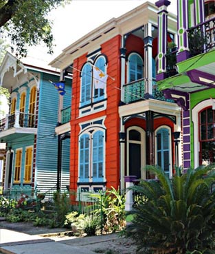
Gentilly, the long, graceful New Orleans neighborhood stretching from Esplanade Avenue up to the Industrial Canal, is an area much favored by retirees, families with young children, and those attending and affiliated with Dillard University, its chief landmark and pride. Built along a naturally occurring ridge, Gentilly's housing stock ranges from 19th-century shotguns to early 20th-century bungalows and mid-20th century ranch houses, all set in a landscape of old trees, wide lawns, and the broad boulevard called Elysian Fields, its main thoroughfare.
By most commonly accepted definitions, the Gentilly neighborhood is bounded by Lake Ponchartrain to the north, France Road to the east, Bayou St. John to the west, and the Louisville and Nashville Railroad to the south. The major north-south streets are Franklin Avenue, Elysian Fields Avenue, St. Anthony, St. Bernard, St. Roch, Paris Avenue, Wisner, A.P. Tureaud (formerly London) Avenue and Press. The main east-west streets are Lakeshore Drive, Leon C. Simon, Robert E. Lee (a section of which was formerly called Hibernia), Prentiss, Harrison, Filmore, Mirabeau, Hayne, Chef Menteur and Gentilly.
The first part of Gentilly to be developed was along the Gentilly Ridge, a long stretch of high ground along the former banks of Bayou Gentilly. A road, originally called "Gentilly Road," was built on the ridge, and formed the eastern path into the oldest part of the city, today's French Quarter to Chef Menteur Pass. The high ground became Gentilly Boulevard and U.S. Highway 90, part of the Old Spanish Trail from St. Augustine, Florida to Los Angeles, California.
Settlement was originally mostly confined to houses along the long narrow ridge, plus Milneburg (home of the Milneburg Lighthouse), built on elevated piers on the shore of Lake Pontchartrain. Most of the ground between the ridge and the lake was swampy. The first residential section adjacent to the ridge, the early 20th-century Gentilly Terrace, was built by excavating and piling up the earth in the shallow swamp to create blocks of terraced land where houses could be built. With the development of improved drainage pumps, land reclamation and higher lakefront levees, the land extending from the ridge to the lake was developed by the mid-20th century, and the entire area popularly came to be known as Gentilly.
Gentilly's reach has been variously delimited. Some definitions include a somewhat wider area, extending the neighborhood into the Upper 9th Ward. Some older New Orleanians extend Gentilly even farther, to include the section of old Gentilly on the east side of the Industrial Canal, now part of Eastern New Orleans. Other definitions diminish the area occupied by Gentilly by placing its western boundary along the London Avenue Canal, not Bayou St. John, and the northern boundary along Leon C. Simon Drive, not the shore of Lake Pontchartrain. By this reckoning, Vista Park and Oak Park, lying between the London Avenue Canal and Bayou St. John, fall outside of Gentilly, as do the Lakefront subdivisions of Lake Terrace and Lake Oaks, and the lakefront campus of the University of New Orleans.
Gentilly was hard-hit by Hurricane Katrina, and is still struggling to rebuild. While some residents have returned and are reclaiming their houses piecemeal, the neighborhood still awaits direction from the city regarding its future footprint and land usage requirements.


